Water and heat have always been topics in human history. Of course, these days we connect the topic of climate change with both of them. I’m not sure, though, how much people thought of climate back in the day. They surely observed what Nature was dealing them, and the Bible – as probably lots of other written or painted contemporary documents – is filled with such narratives of natural phenomena.
Maybe the oldest scientific “apparatus” to measure water levels is the “nilometer” in Cairo, Egypt; its name relates to the river Nile, of course, and it dates back to 861 A.D. One prior in its place had been ordered as early as 715 A.D. Of course, the simplest to observe would have been a staircase – you wouldn’t even have had to be able to read any measurements. But there were also vertical measures as we know them today, and wells with culverts. Of course, we all know that Egyptian agriculture relied on the annual floods, and I imagine how everybody longed for the water to rise each and every season it was supposed to happen. But there is also the story of Joseph that tells us of the seven meager years – so, people must have been desperately staring at these gauges.
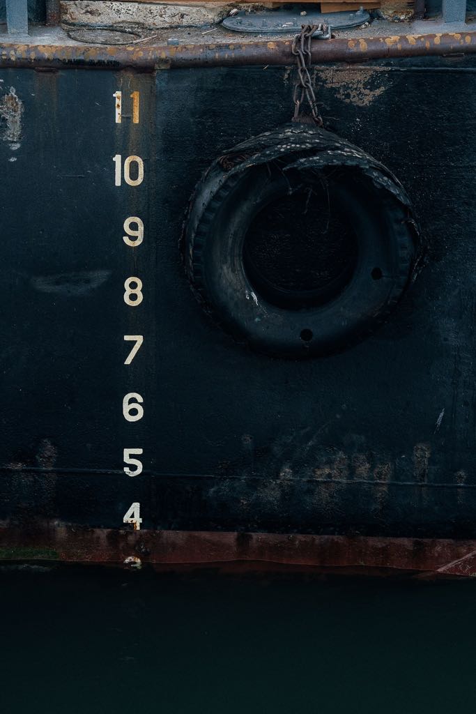
Modern water gauges have their zero-level marked where the usual water level of a waterbody is situated, no matter whether it’s a lake or a river. It doesn’t tell you anything about the actual water depth. But you can work out for yourself whether the water is low (as in below the zero-level) or high. Depending on the duration of one’s observation, you can find out about how fast a river rises after strong rains and probably even assume whether there will be floods at a certain point. Or you have a measurement for how much cargo a ship can load on lower levels in order to make it safely to its destination. Metereologists probably hand their ledgers from generation to generation, as they must be fascinated by the connection of the “behavior” of water levels with climate.
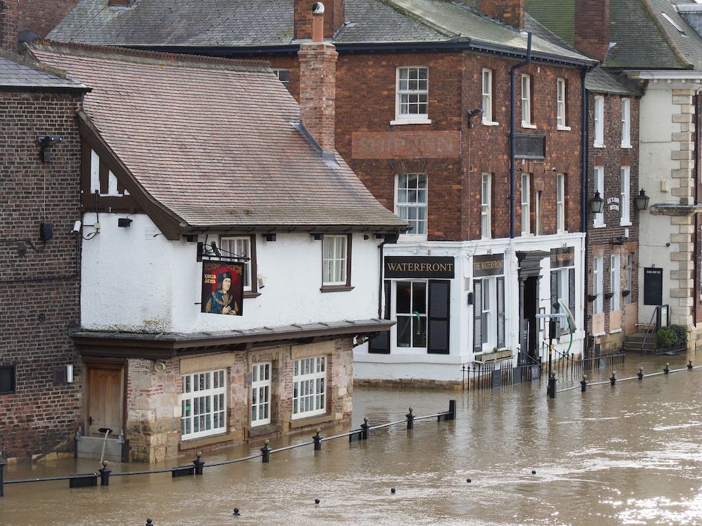
If you have ever traveled Germany, you will find lots of old houses in towns by rivers that show vertical metric lines next to their doors or windows. These are witnesses to river floods that affected the respective town. It is sometimes daunting that such old houses are still standing. You probably remember the terrible flood in Germany last year – a lot of houses and even bridges with such devices didn’t make it through. And we have only recently seen in Kentucky that seemingly friendly bubbling creeks can become deadly highwater torrents.

Currently, Europe sees a different phenomenon – droughts that dry out even ginormous rivers such as the Po, the Danube, and the Rhine. Ah, you might say, but so do we! Just have a look at Lake Meade and the boat wrecks on its bottom – and who knows how many corpses?! True. But these have been there no longer than the Hoover Dam. Now, check the river Rhine – an entire harbor from the Roman times has become visible near its central banks. In some places, ships can’t carry their full cargo anymore because the water level has sunk so much. So, these water gauges come in really useful now!
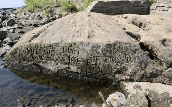
The most striking feature that pops up these days in European rivers, though, are something that was recently pointed out to me by a historian and anthropologist with whom I always have a nice chat when I run into him during his work hours at Fred Meyer: hunger stones. These are rocks that fall dry during extreme droughts and have been marked with the numbers of the years in which they happened. There are quite a few in the Rhine, the rivers Elbe and Weser, but also in rivers of other nations. Evidently, these rocks mark periods of famine that occurred due to such droughts. Though historians will place the main period of hunger stones between the 15th and 19th century, there are rocks that are dated as early as 1115. Which, again, means, that somebody must have observed the water level as early as that and figured that it had never been as low as that before. Ever.

No matter whether drought or flood, to me it is fascinating how very early people have tried to figure out water levels and their economical meaning already. They must have been quite educated at their height of time. They were able to create gauges of one kind or another, they were able to write letters and numbers. Today, we have so much more at hand when delving into such sciences. Let’s just ponder what interesting people they must have been in their times and what knowledge they have left to us.
Source: The Suburban Times

Recent Comments